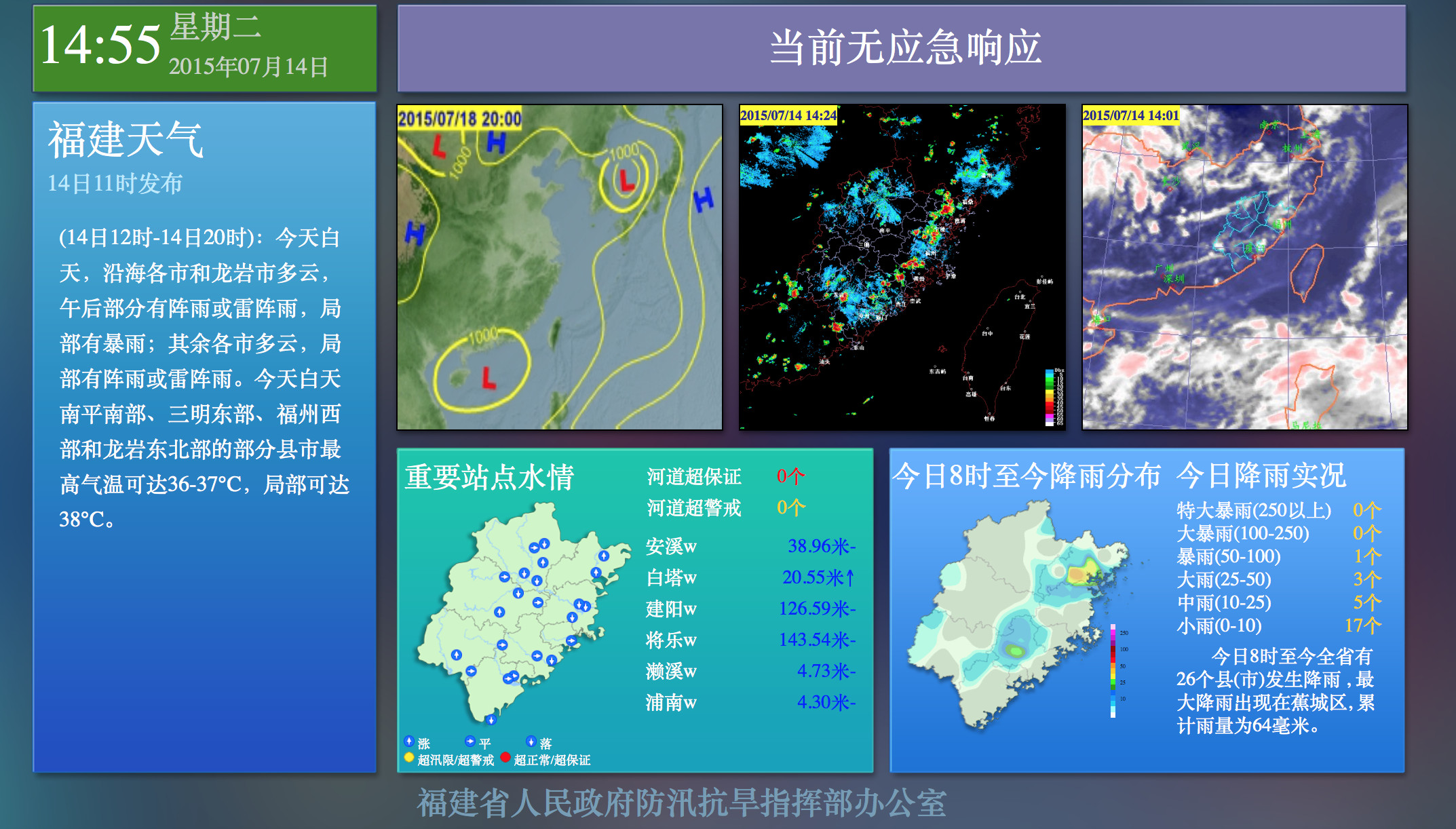
Fuzhou City Flood Risk Map System Project
Many cities in our country are inevitably flooded and paralyzed during heavy rains. To alleviate urban water disaster issues, Istrong Software has launched the Urban Flood Risk Map Management System. By establishing a downstream flood analysis hydrological model, we can reflect the range and extent of possible flooding in the city when floods of different frequencies occur, or due to dam breaches and dyke failures. It shows the flooding process and reproduces it in the form of an electronic map. It is beneficial for departments at all levels to grasp the historical flood situation in time, make advance flood predictions, and provide an important scientific basis for flood control decisions.
Case: Fuzhou City Flood Risk Map System Project
Fuzhou City is located at the lower reaches of the Minjiang River, and the upstream heavy rain generally gathers to the lower reaches of Fuzhou in about one day. Flood attacks frequently occur in Fuzhou city. Istrong Software has established a downstream flood analysis hydrological model for the Fuzhou City Flood Control Office, completed flood risk maps of different frequencies, improved and enriched the data of the internal flooding risk model, optimized the risk map revision system, provided reliable subsequent maintenance and training, and provided support for the Fuzhou City Flood Control Office to fight against floods.


 Home
Home
 WeChat
 400-620-1615

 Headquarters Address:ISTRONG Technology Building, Xingwang Science and Technology Park, No. 9 Gaoxin Avenue, High-tech Zone, Fuzhou
 Phone Number: +86 591-22850288
  Fax: +86 591-22850299
 E-Mail:strong@istrong.cn
 闽公网安备 35012102500164号