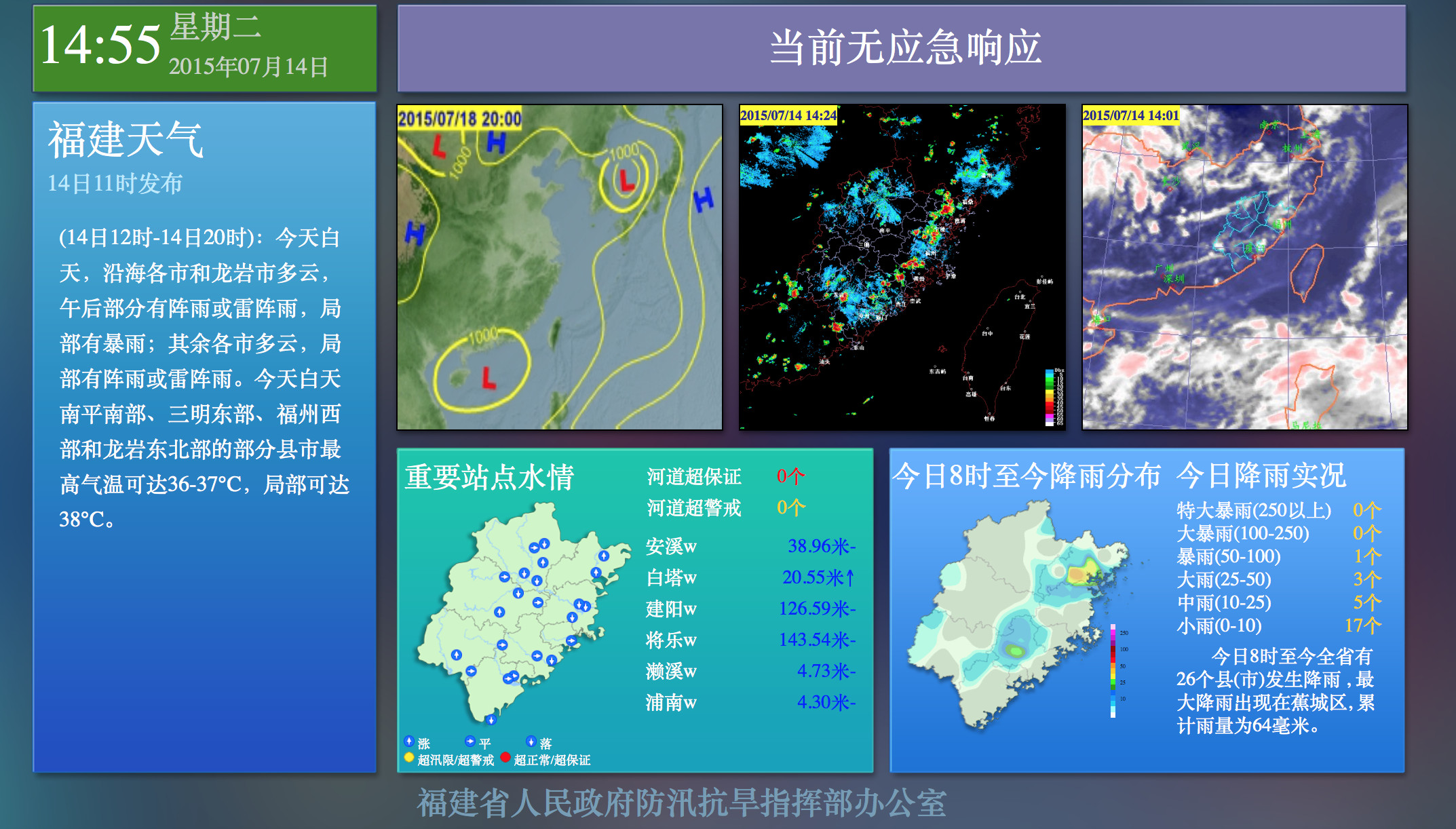
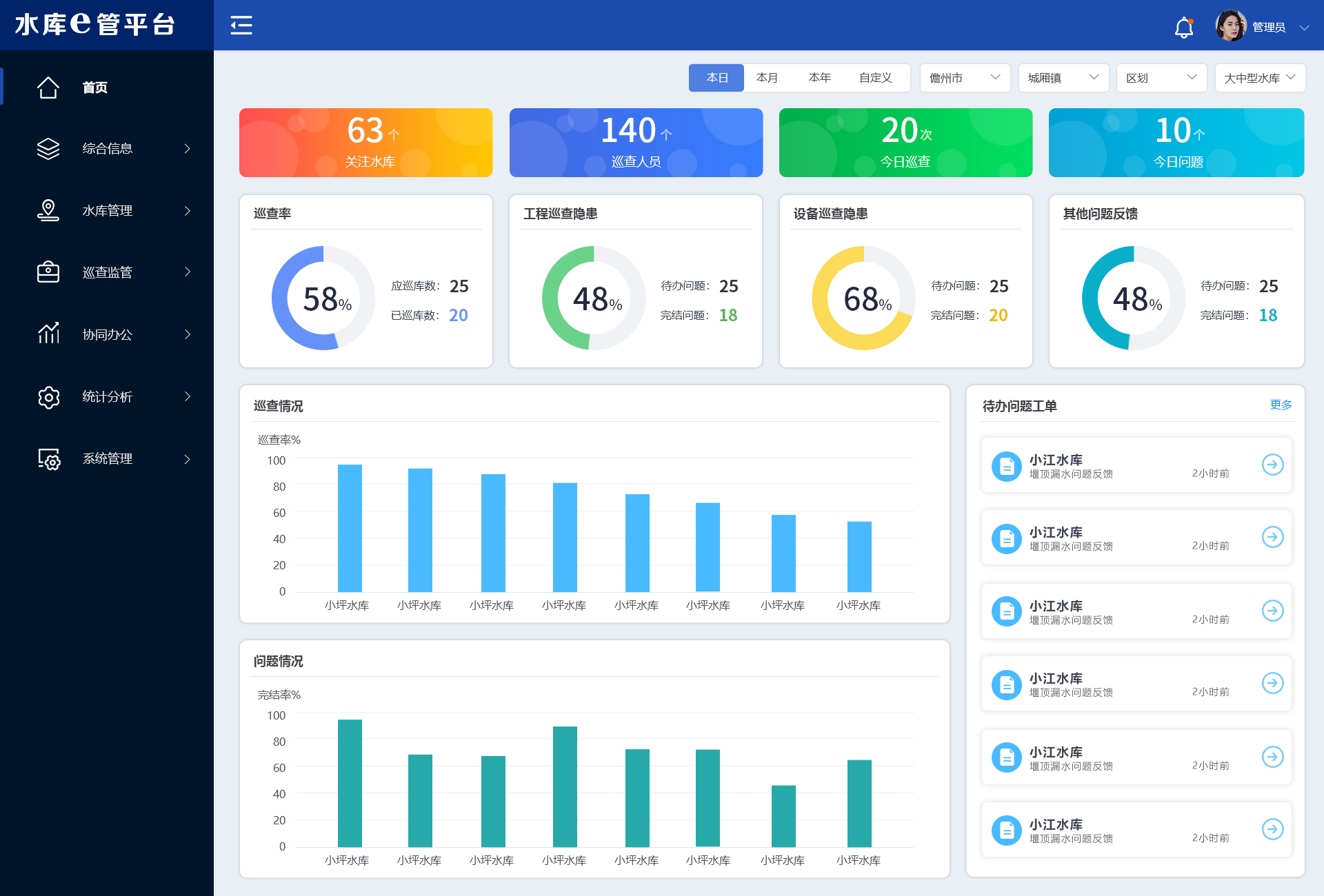
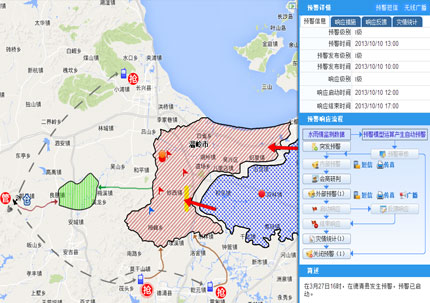
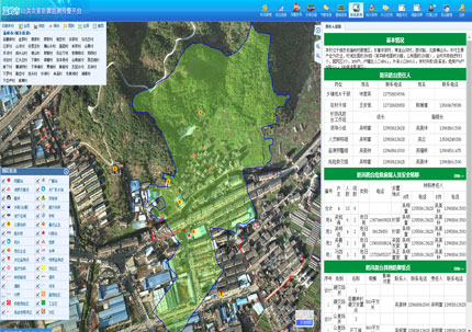
Emergency command and dispatching in flood control involves a wide range of aspects and often requires rapid acquisition of disaster information and taking action. As paper flood control command maps involve complex element plotting and cannot obtain flood control element attribute information or real-time data, this affects forecast evaluation and decision-making. This system is based on a GIS platform and implements the superimposed application of various flood control elements, intuitively displaying the distribution of mountains, water, cities, roads, and flood control facilities. It combines business requirements to generate a "one-map" for flood control, wind prevention, and drought resistance business to analyze the disaster relief situation. It quickly grasps the distribution of danger points, relief materials, and relief forces, providing strong data support for command decisions and refugee relocation. The system helps enhance the ability of emergency flood control, strengthen scientific scheduling, improve disaster relief efficiency, and meet the needs of maintaining a large amount of element information such as "decomposition, online plotting, hierarchical reporting, and linkage update", greatly relieving the work pressure of grassroots flood control personnel at all levels.


 Home
Home
 WeChat
 400-620-1615


 Headquarters Address:ISTRONG Technology Building, Xingwang Science and Technology Park, No. 9 Gaoxin Avenue, High-tech Zone, Fuzhou
 Phone Number: +86 591-22850288
  Fax: +86 591-22850299
 E-Mail:strong@istrong.cn
 闽公网安备 35012102500164号